


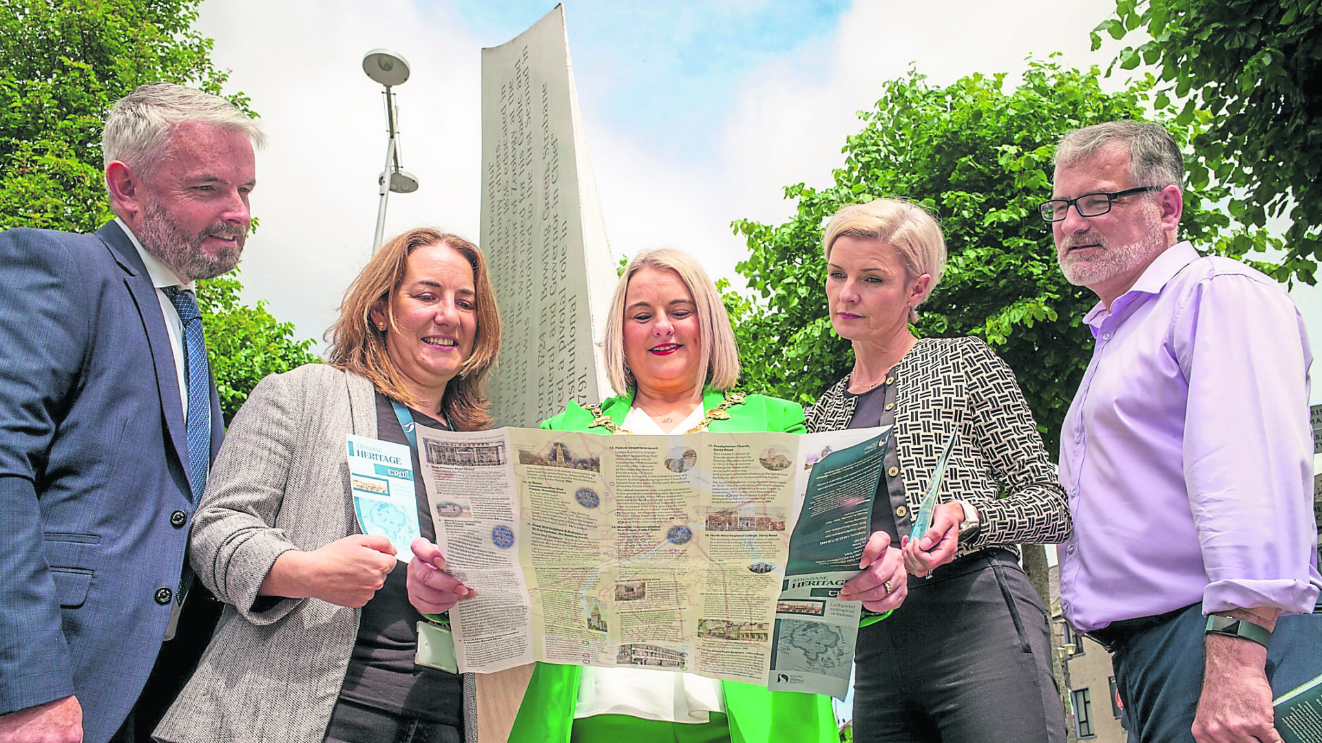

An illustrated map which celebrates the rich heritage and landmarks of Strabane, and encourages the public to take a self-guided walking tour to explore the history of the town, has been launched by the Mayor.
The map showcases the ‘Strabane Heritage Trail’, a self-guided walking tour of approximately 3.5 miles (5.5 kilometres), and encourages the public to step outside and experience some of the delights of the town that are right on their doorstep.
Walkers are invited to start their journey of discovery from Railway Street at the Alley Arts and Conference Centre, and follow the town’s historic story by visiting over 28 locations of local interest that spans across the centuries right through to modern times.
They will be able to see at first-hand how the town has evolved from its early settlement years to its current form.
The map covers a wider range of themes, including the town’s industrial heritage, such as the important role that Strabane played in the local shirt making industry, as well as its ancestral heritage, and the many famous names associated with the town, including hymn writer Cecil Frances Alexander.
It also features recent historic additions, such as the impressive 10 metre tall ‘Let the Dance Begin’ (The Tinnies) sculpture, which was installed to mark the turn of the new millennium.
It is hoped the map will encourage locals and visitors alike to take their own journey of discovery of our town and find out more about the local heritage and history and celebrate Strabane’s unique transition and development through the centuries.
Speaking at the launch, Mayor of Derry City and Strabane District Council, Cllr Sandra Duffy, said she was ‘very impressed’ with the map, and the huge number of interesting historic places of interest featured in the publication.
Journey
Extending her thanks to everyone associated with the map, the Mayor said she was confident it would be well utilised and enjoyed by the local community and tourists.
“I like the way the map encompasses the historic delights of Strabane, and really invites people to embark on their own journey of discovery and exploration of the town by encouraging them to visit local landmarks and places of interest to find out more,” she said.
“The heritage map really whets your appetite to find out more detail about each of the 28 locations listed.
“It encourages people to drop into the local library or join a local history society, and also makes reference to the extensive number of publications available that give more detailed information and insight into the heritage and history of Strabane.
“A lot of research, commitment and hard work has gone into getting the map together and I sincerely hope that it will be utilised by locals and visitors with an interest in finding out more about Strabane’s unique heritage and history,” she added.
The map is available at Strabane Visitor Information Centre, the Strabane Community Library and Visit Derry offices.
Trail users are advised to exercise caution when crossing roads, and to use pedestrian crossing points where available.
They are advised that only some of the locations on the map have full access, others are accessible during specific opening hours, by appointment or with the owner’s permission.
• For further information on the map and its development, contact Philip McShane, rural tourism officer with Derry City and Strabane District Council.